Hiking – Walking trails
Guided daytours around the southern part of Westfjords
We are in cooperation with Umfar witch offers guided hiking trips around the area.
Hörgsnes
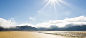
Here you find the cave Gíslahellir and strange cliffs with numerous holes and pockets. The Hörgur, from which the place gets its name, is a crag dotted with holes. Nearby is a lovely beach where it is common to find seals sunbathing.
Marked 30 – 60 minute walk. A climb of approx. 50 meters.
Smiðjutóftin (The Forge)
Just west of the Þingmannaár River, about 200 eters above the highway are ruins marked with a yellow pole – a standard practice for archaeological sites. Here are found charcoal emains. The site is very old and said to be the remains of the forge of Gestur Oddleifsson the Wise, but this is hardly likely. The forge would have been a time-consuming occupation because it is 20 kilometers from here to Hagi, Gestur’s residence.
Þingmannaá
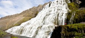
An interesting river canyon with pristine waterfalls, both large and small. It is easy to walk behind one of them, so much so that the location has been used in two films, “Útlaginn” (The Outlaw) and “Nonni & Manni”. In the canyon, the end of a dike can be seen. The volcanic river of lava here ran in much the same way as the magma bursts in the eruption of Krafla in 1980. This type of volcanic flow happens at least a kilometer below the surface so the dike bears witness to how brutally the glaciers scoured the Þingmannadalur valley.
Marked 60-minute walk. A climb of 200 meters.
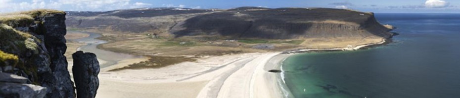
Vatnsdalur Valley
The mountains, the woods, the lake and the river make up the picturesque scenery here which is best enjoyed on foot along good hiking trails on either side of Vatnsdalur. The birch on Lambagilseyrar east of the lake is among the highest found in Vestfirðir. There are some lovely waterfalls in the valley base. Please note that the Vatnsdalsá and Útnorðursá rivers, which run down the valley base to the west, are usually difficult to cross and can be dangerous.
Marked two-hour walk to the Lambagil gulley. No climb. Other walks also possible.
Smalahellan
The Smalahellan, a barren spot where spring water gushes over a slanting flat rock, is situated inland in the western part of the valley. It was said that no shepherd would be considered competent in Vatnsdalur unless he could run across the rock slate. Almost needless to say, the feat is impossible because of how slippery and steep the slab of rock is.
Helluvatn
North of the hotel at Flókalundur is a lake. It is a short walk to the lake, providing a chance to see the area from a different point of view without too much hassle. It is a nice view overlooking the hotel and summerhouse area.
Marked two-hour walk to Helluvatn. A climb of 300 meters.
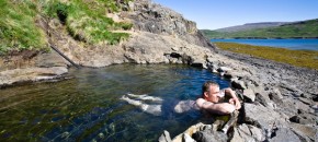
Pennugil
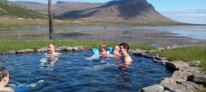
A dramatic canyon with striking rock formations. In the canyon there is a small hot spring in which road workers used to bathe.
Marked 30-minute walk. A climb of 50 meters.
Lómfell
This is the mountain we mentioned earlier that was the first mountain ever climbed in Iceland – and the view it provided was the source of Iceland’s name. There is a good view over Breiðafjörður and the southwestern highlands of Vestfirðir. The desert and expanse offer a refreshing change from the lush lowland between the steep mountains.
Marked walk of two to three hours. A climb of approx. 350 meters.
Surtarbrandsgil
This canyon is in fact not part of the reserve but enjoys special protection as a natural phenomenon. It is strictly forbidden to disturb or remove anything in the canyon but it is possible to obtain permission to walk around. Surtarbrandsgil, one of the most famous fossil sites in Iceland, boasts remains of Tertiary vegetation 12 million years old. Giant pine, maple, magnolia and beech are among the most common fossilized species found there.
90-minute walk. A climb of 200 meters.
Flókatóftir
Ancient and protected ruins just west of the dock at Brjánslækur. They are named after Hrafna-Flóki.
Five minute walk.
source: ust.is / The Environment Agency of Iceland
 More →
 More →
 More →
 More →
 More →
 More →
 More →